


Exterior Maps & Directions to Lakewood Campus
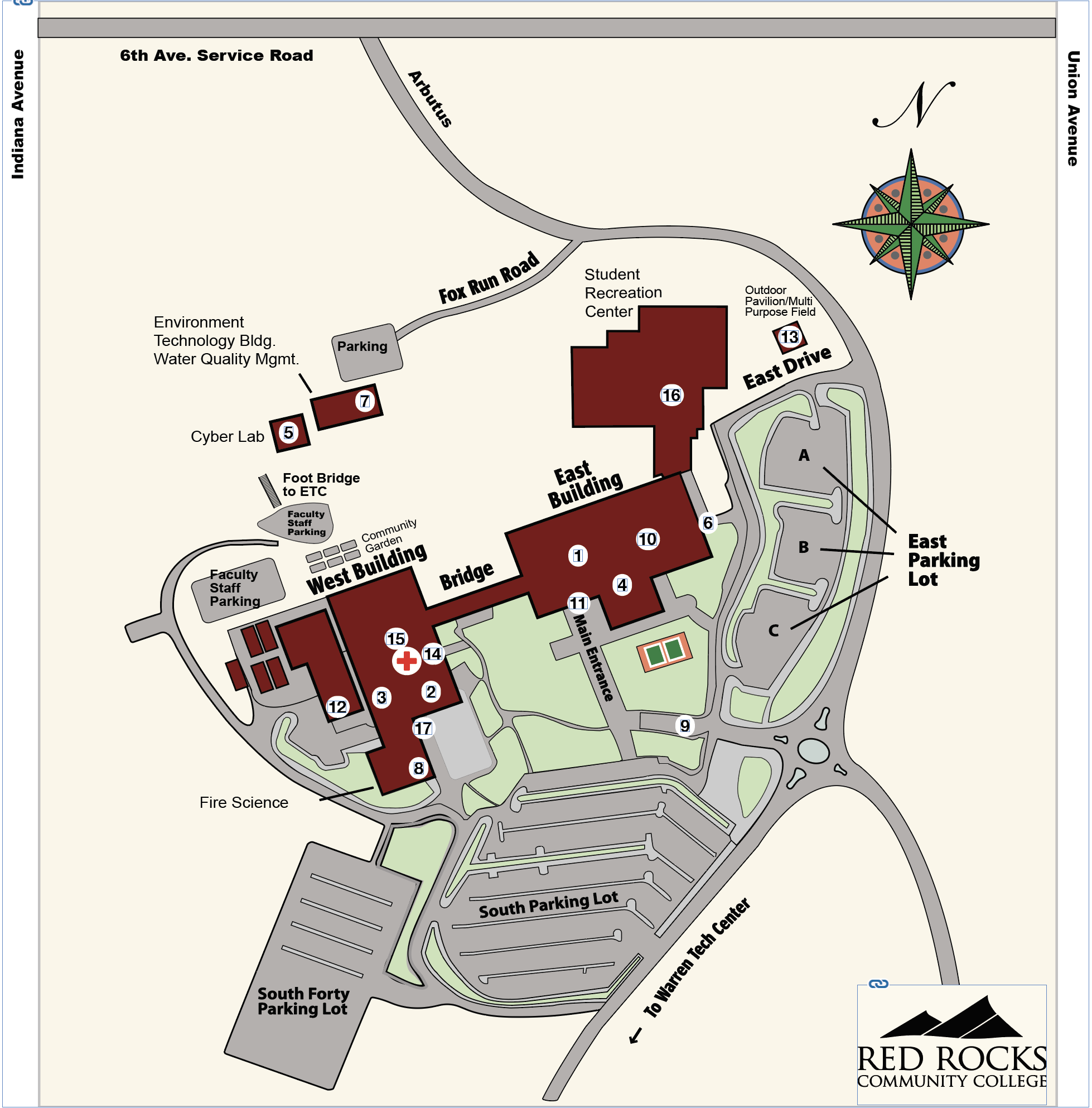
Visual Overview - Lakewood Campus
An overview of parking areas and buildings on the RRCC Lakewood Campus
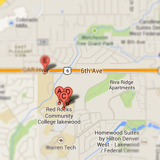
Lakewood Campus - Road Map/Directions
Driving directions and a road map of areas surrounding the Lakewood Campus
The Lakewood campus of Red Rocks Community College is located off the Sixth Avenue Freeway at 13300 W. 6th Ave, Lakewood, CO 80228, just 15 minutes from downtown Denver.
From downtown Denver: take the Sixth Avenue Freeway west to the Union/Simms Street exit. Turn left (south) on Union to 4th Avenue. Turn right on 4th Avenue (west) and bear right past the Point Athletic Club. Continue west on Sixth Avenue Frontage Road to the entrance sign for the college. Turn left at the sign (Arbutus Drive) and continue to the college, which is located on the west side of Arbutus.
From Golden: take the Sixth Avenue Freeway east to the Indiana Street exit. Turn right (south) on Indiana to the first light. Turn left (east) on the Sixth Avenue Frontage Road and continue to the entrance sign for the college. Turn right at the sign (Arbutus Drive) and continue to the college, which is located on the west side of Arbutus.
 Need public transportation? Go here for bus and light rail schedules to our campuses.
Lakewood and Arvada campus Wifi Map


